
VeasDei
Measure land on a satellite map
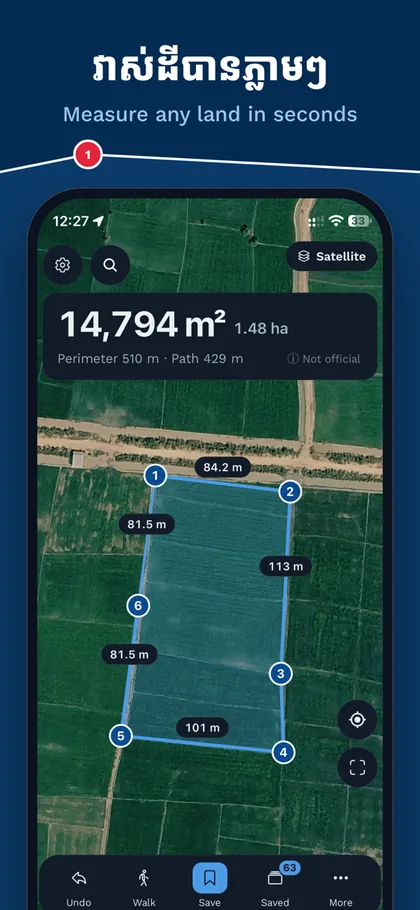
VeasDei turns an iPhone into a land-measuring tool. Tap the corners on a satellite map — or walk the boundary — and see the area, the perimeter and every side length.
 Android: coming soon
Privacy policy
Measuring
- Tap the corners on the satellite map — area in m², hectares, acres and more.
- Walk mode: walk the boundary and GPS draws the shape.
- GPS averaging for better corners, with the accuracy (± metres) shown.
- Every side length on the map — or hide the numbers for a clean map.
- Drag a corner to adjust it, add a corner between two others, undo anything.
- Crosshair mode for precise placement.
- It warns you when two lines cross, and fixes the shape in one tap.
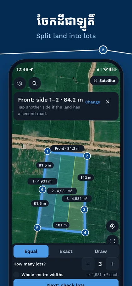
Split land into lots
- Split a plot along its road: Equal, Exact (m², % or metres wide) or Draw Shape.
- Draw Shape is free for now — draw a lot of any shape, then drag its corners.
- Join lots, mark more than one road, and see which lots have no road access.
- Every lot shows its sides, area and price; one share card and one PDF cover the whole split.
- A plot with lots keeps its shape: its corners stay locked until you unlock them.
For land deals
- Title vs Real: type the area from the land title and see the difference in m² and %.
- Price calculator: price per m² or hectare to a total, in US dollars or riel.
- Notes on every plot.
Share and export — all free
- A PDF land report: the plot drawn from its corners, with the area, every side length, corner coordinates and notes.
- A 1080 × 1440 picture card, ready to post or send.
- A share link anyone can open in a browser — no app needed.
- KML, KMZ, GeoJSON, GPX, CSV, Shapefile and DXF for Google Earth, GIS and AutoCAD.
- Import KML, KMZ, CSV and GeoJSON, or paste a list of coordinates to draw a shape.
- Export every plot at once as one ZIP backup.
Search, directions and coordinates
Search places in Khmer or English and get directions (drive, moto or walk), then open them in your favourite maps app. Coordinates are shown in decimal, DMS, UTM (zone 48N) and MGRS, and you can edit any corner by typing its numbers.
Offline, and private
Measuring, saving and exporting work without a connection. Search, directions and share links need one. Your plots stay on your iPhone unless you create a share link — there is no account, no advertising and no tracking. VeasDei is in Khmer and English, follows your iPhone's language, and has dark mode and larger text.
Measurements are for reference only and are not an official land survey.